MAP/MODEL
Project duration: 20 10 14 - 20 11 06
In collaboration with Bradyn Gratton, Danae Mckennitt, Gwyneth De Guzman, Malina Hutsebaut, Nick Gammon, and Tessa Wiebe
If there is no “away”, how can we can we critically investigate notions of contextual space beyond the scale of our immediate living space? How do larger contexts and systems affect our living, its past, present and future? How can larger understandings of systems be developed from discreet investigations of space? How can we read, observe, record, examine and respond to such contexts and systems? How can we record temporal conditions of space or project these conditions from static readings? How do we translate tactile, embodied experiences of space in or on the framework of a map? What might be the strategies, the layers, fragments, and subsystems, effective in understanding and framing the processes embedded within space? How can the act of mapping produce new understandings or narratives of spaces within our everyday milieu?

GROUP WORK
This investigation began at the 1:1000 scale, with each group member mapping a designated strip of approximately three blocks of the Sherbrook area.
Findings at this scale were later broadened to include a larger urban area at a scale of 1:5000.
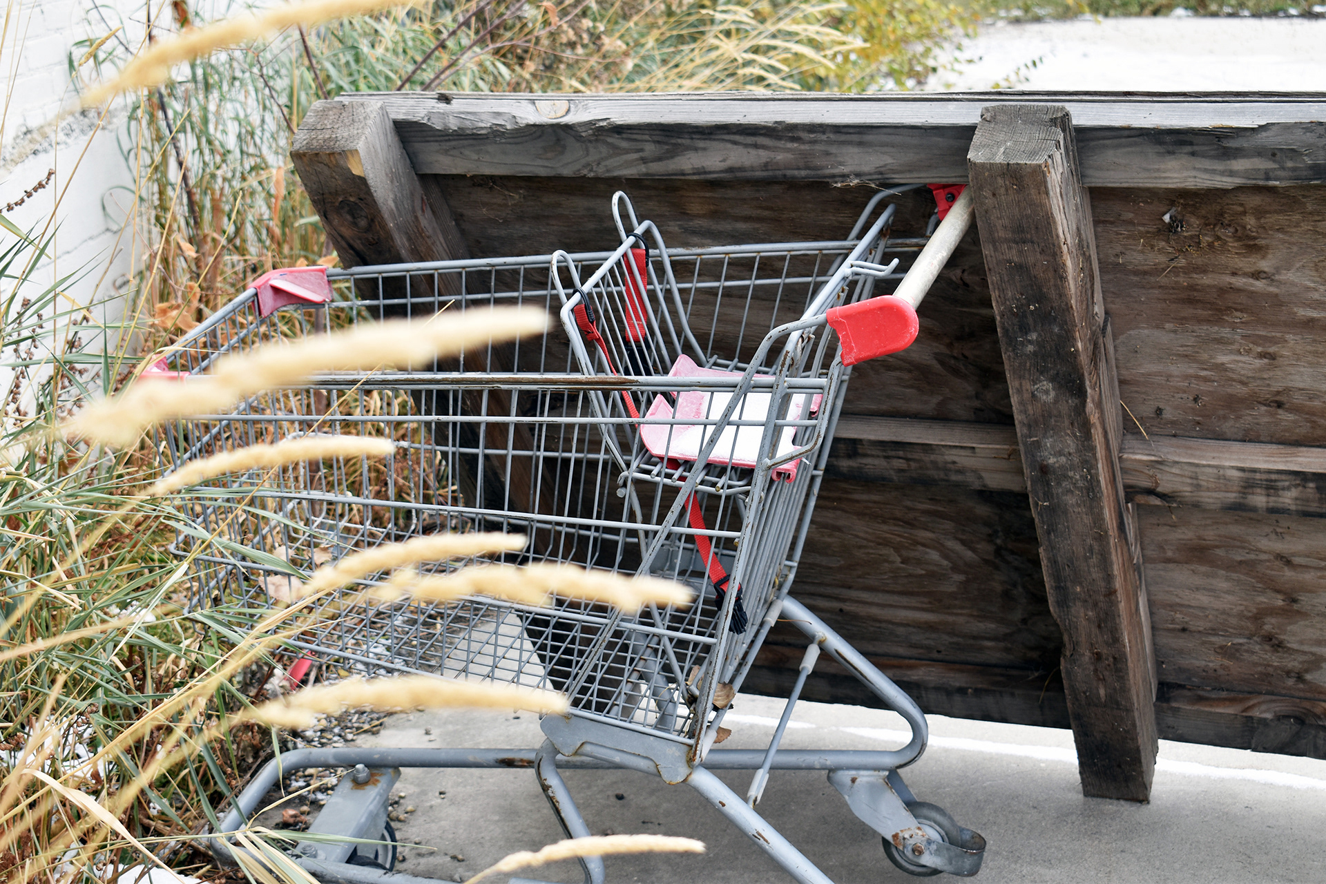
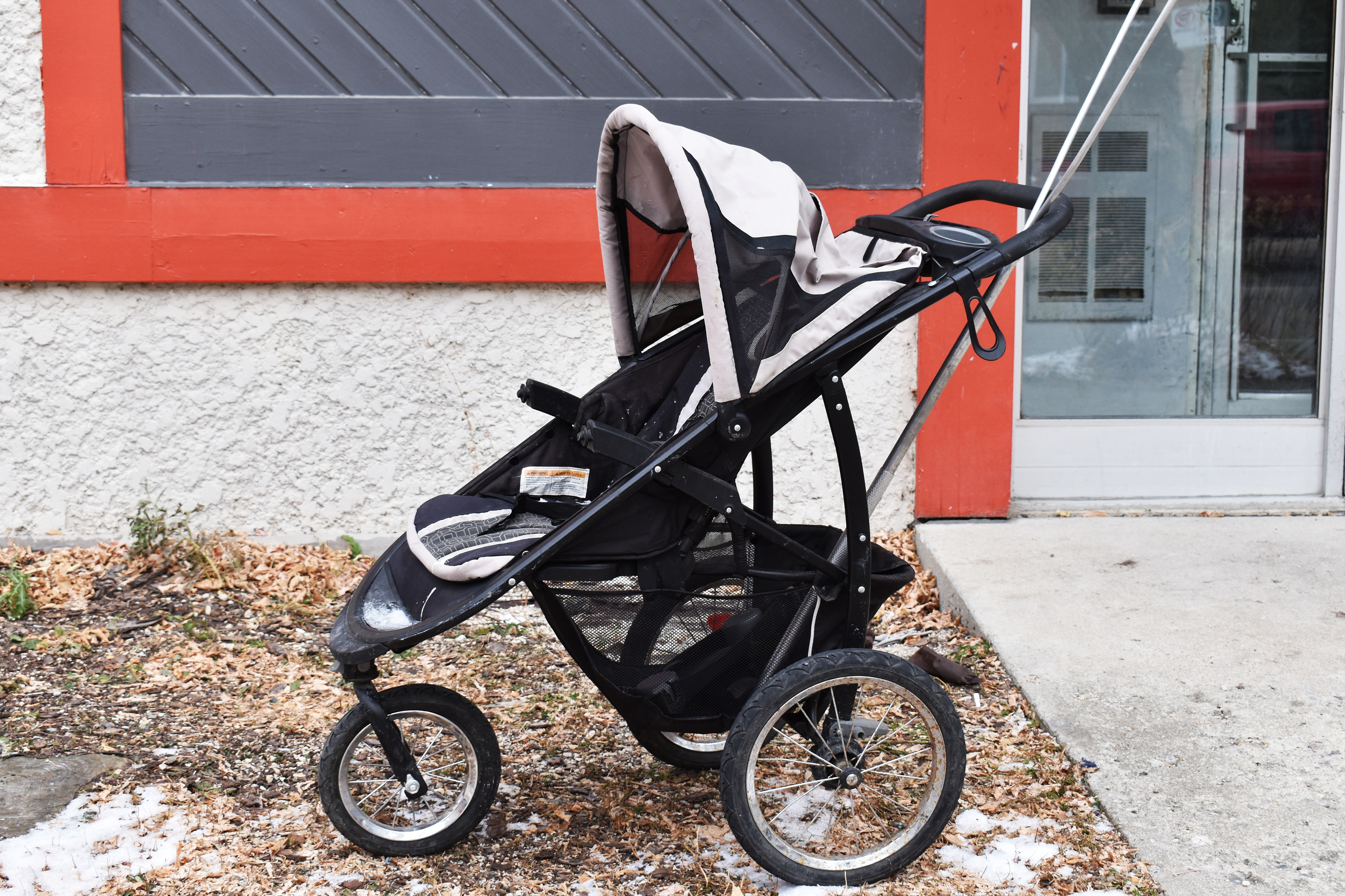
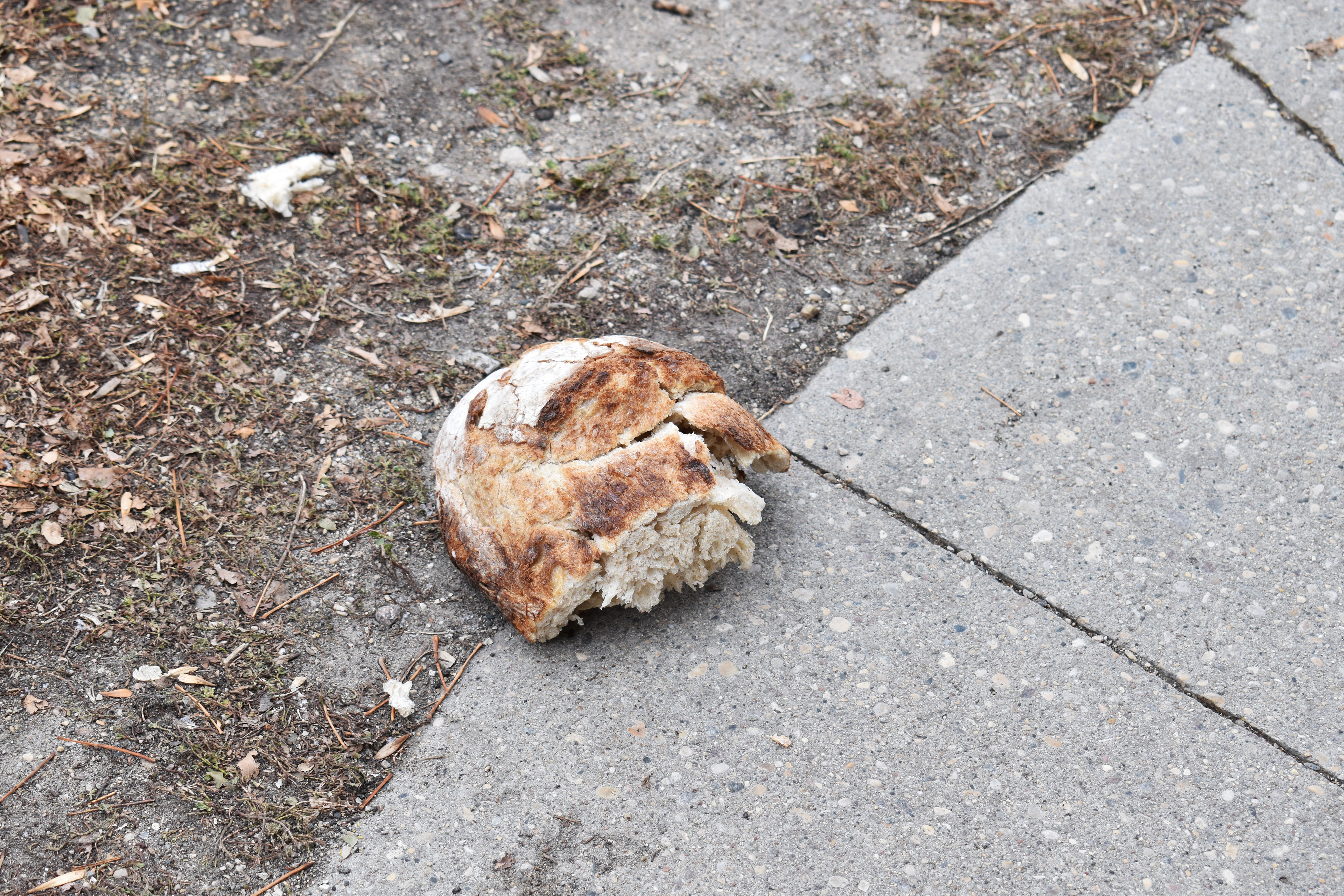
Lost objects were identified to be a common occurrence in the Sherbrook area and became a method of understanding the site.
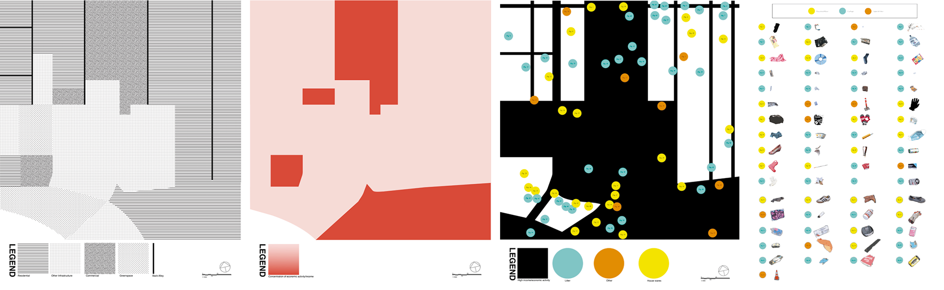
Data on the density of lost objects as well as data/observational assumptions about economic activity and income were collected and visualized. Through analysis and layering of these data sets, it was identified that, generally, the more economic activity in an area correlated to that area also being cleaner. It was additionally noted that back alleys contained more objects than main roads.
Objects identified in the north portage section of the site (1:5000)
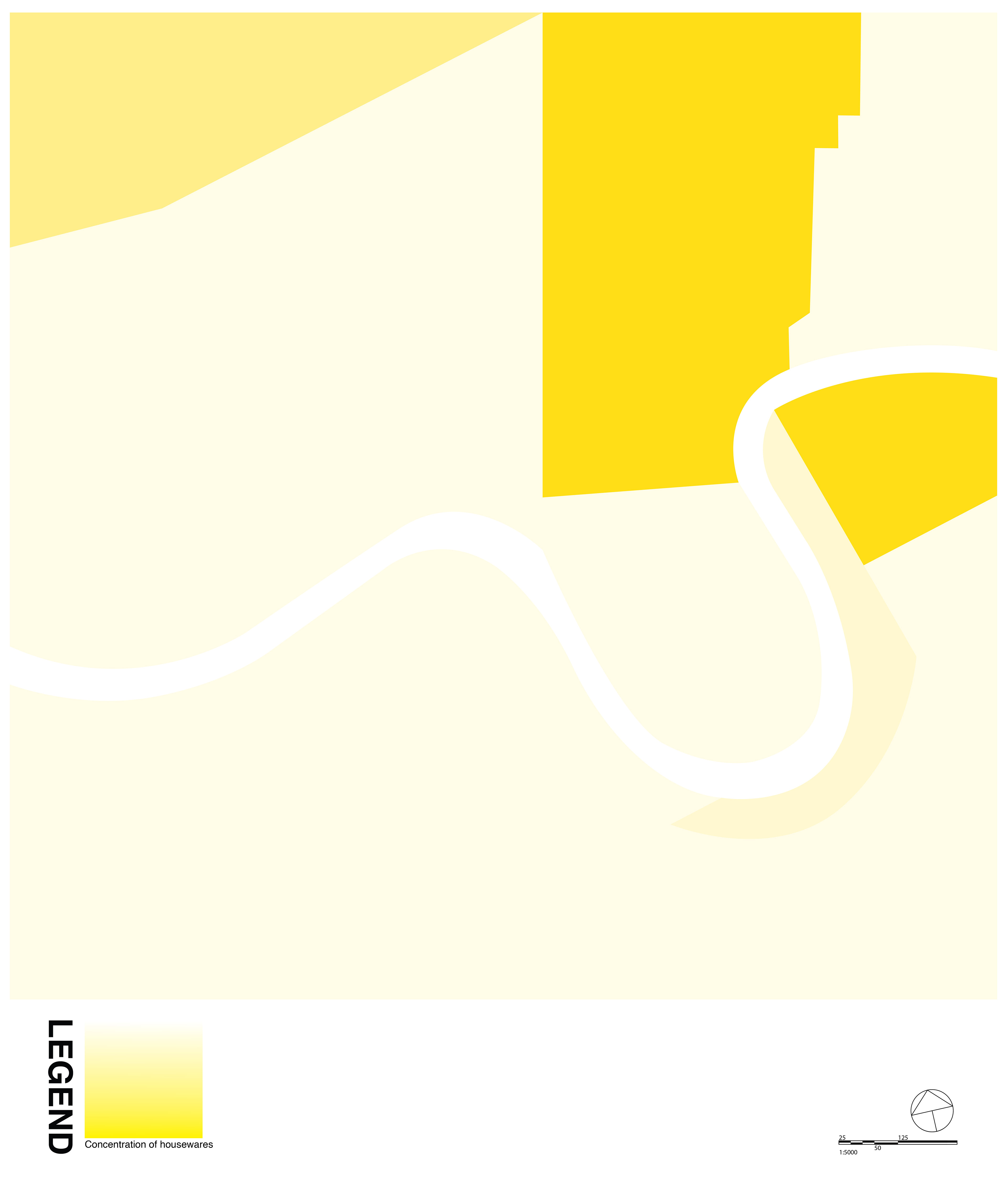


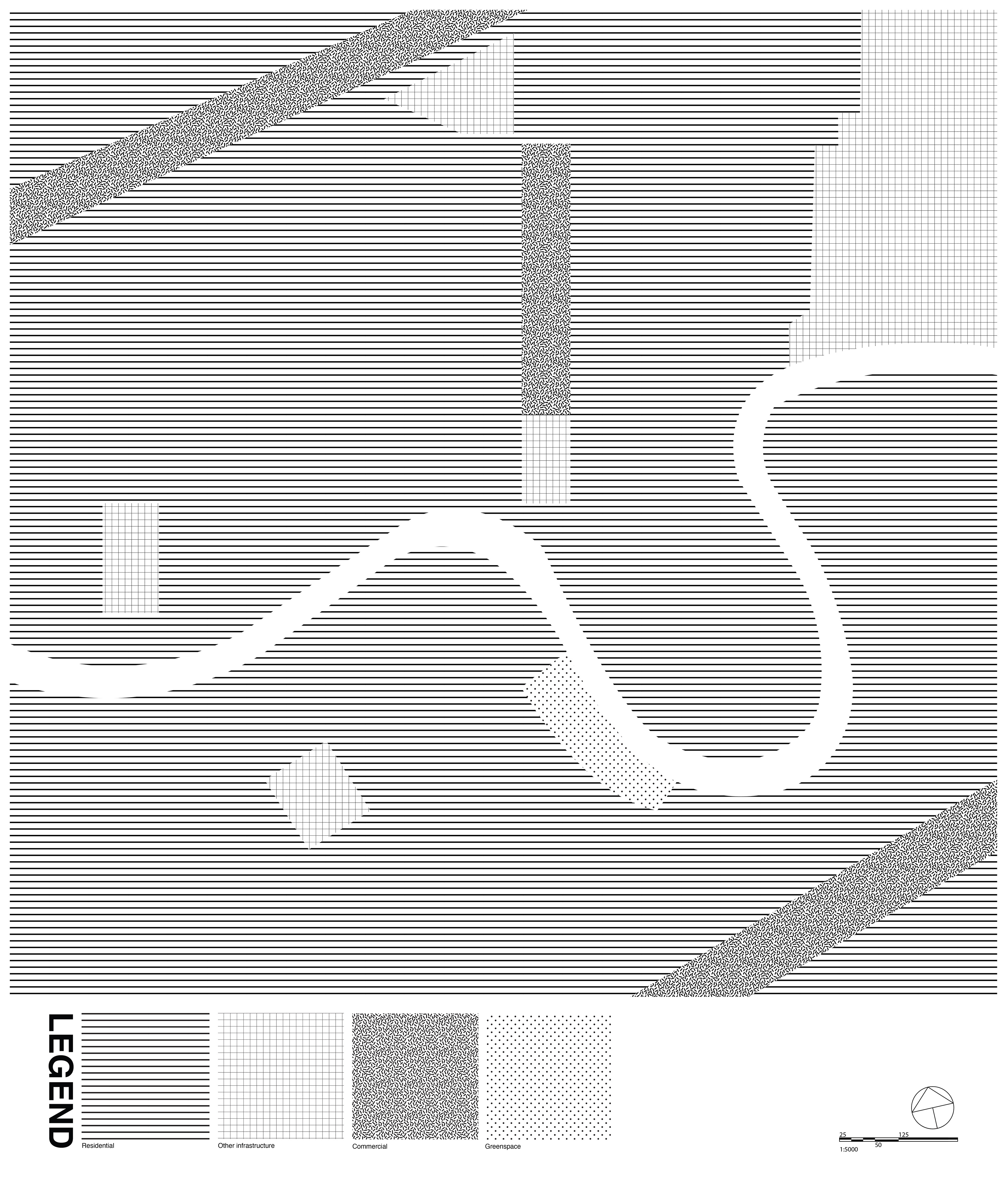

Data on the density of lost objects as well as the average household income per area as designated my the City of Winnipeg were collected, visualized, and compared. In this layering of information, it was revealed that there is a correlation between household income and the general density of lost objects. The areas of higher income were typically cleaner, and most often contained litter, while lower income areas contained more personal items.

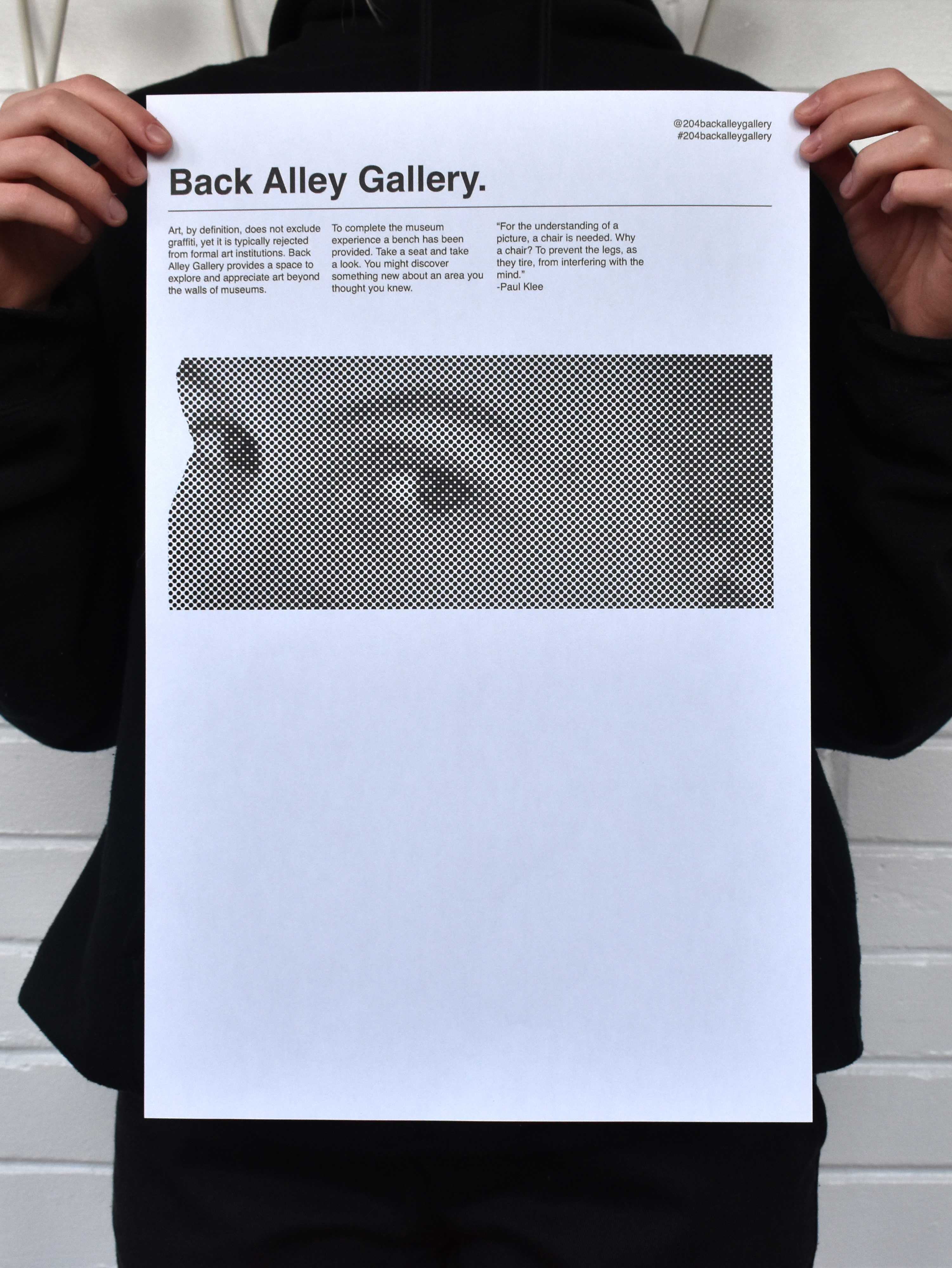
HIDDEN IN PLAIN SIGHT - INDIVIDUAL
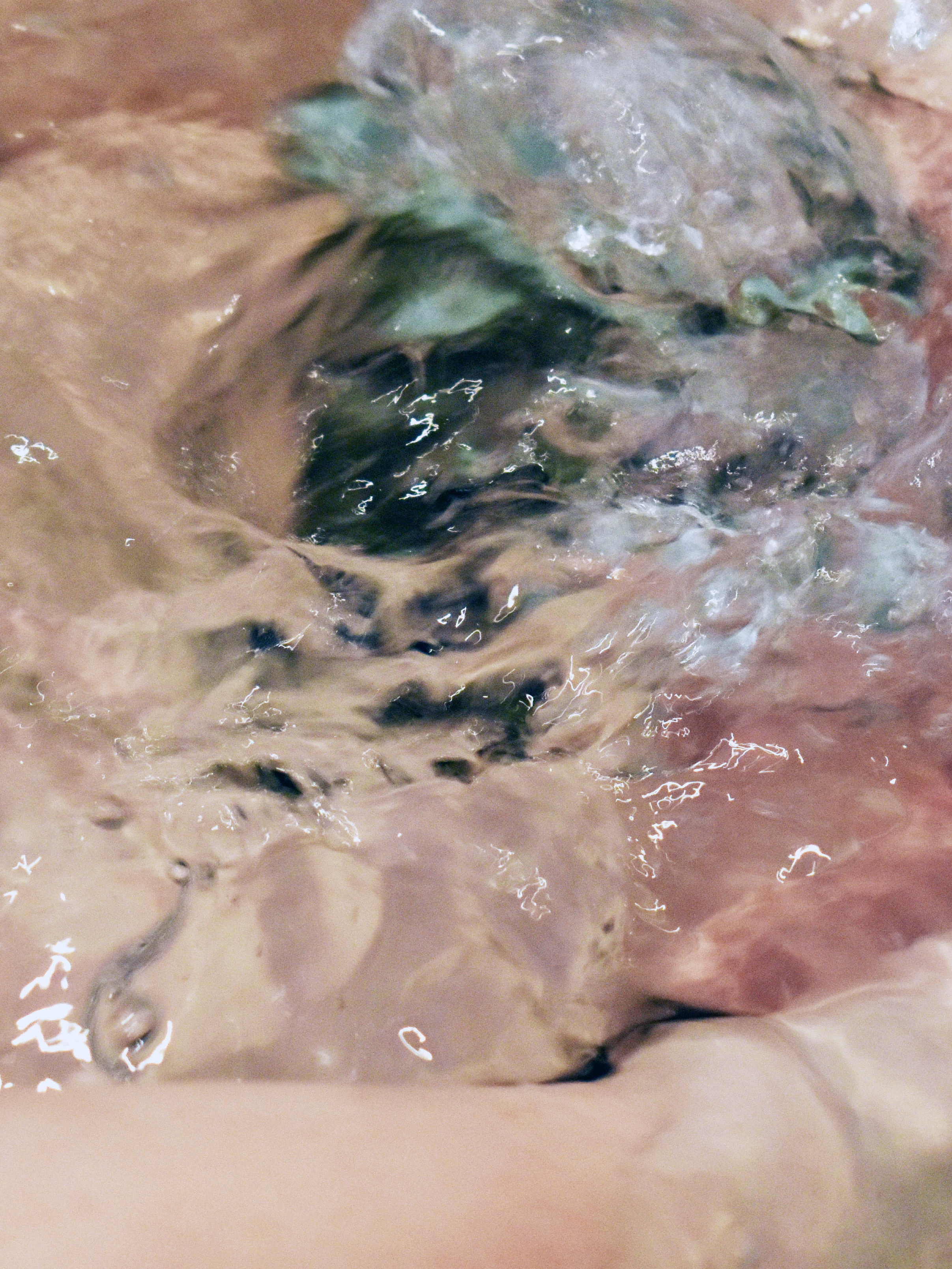
Through site explorations at the 1:100 scale, graffiti was identified as a common occurrence, particularly in neglected and forgotten areas. In back alleys specifically, this art is a bright and engaging addition to largely deteriorating areas. What is unfortunate however, is that these areas, for the most part, go unexplored. They are neither main thoroughfares for pedestrian or vehicular traffic, and tend to be seen as dirty and dangerous. The goal of this mapping exercise then became to challenge the perceptions of back alleys, and show what is missed by not stepping beyond the prescribed path.
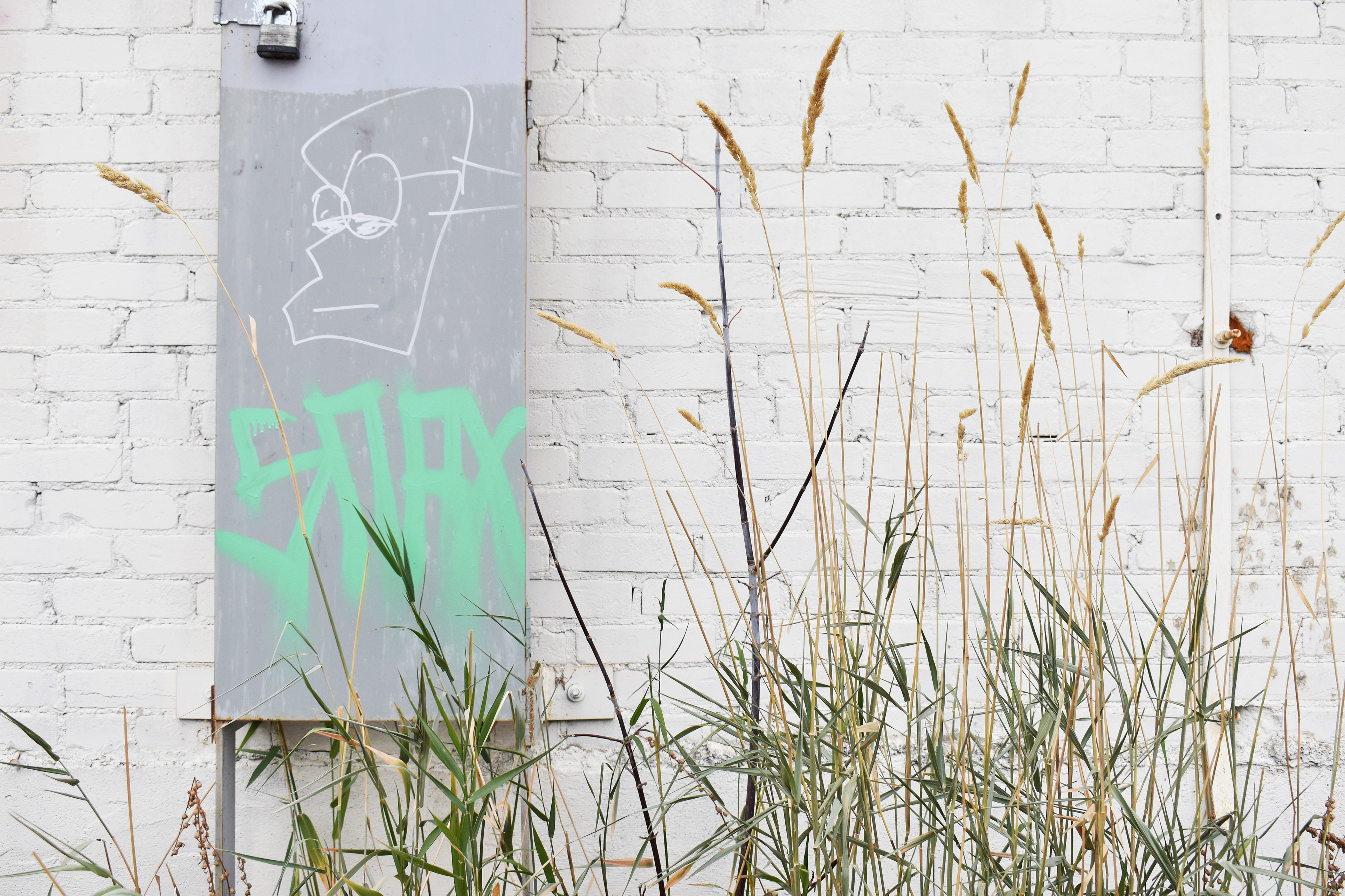
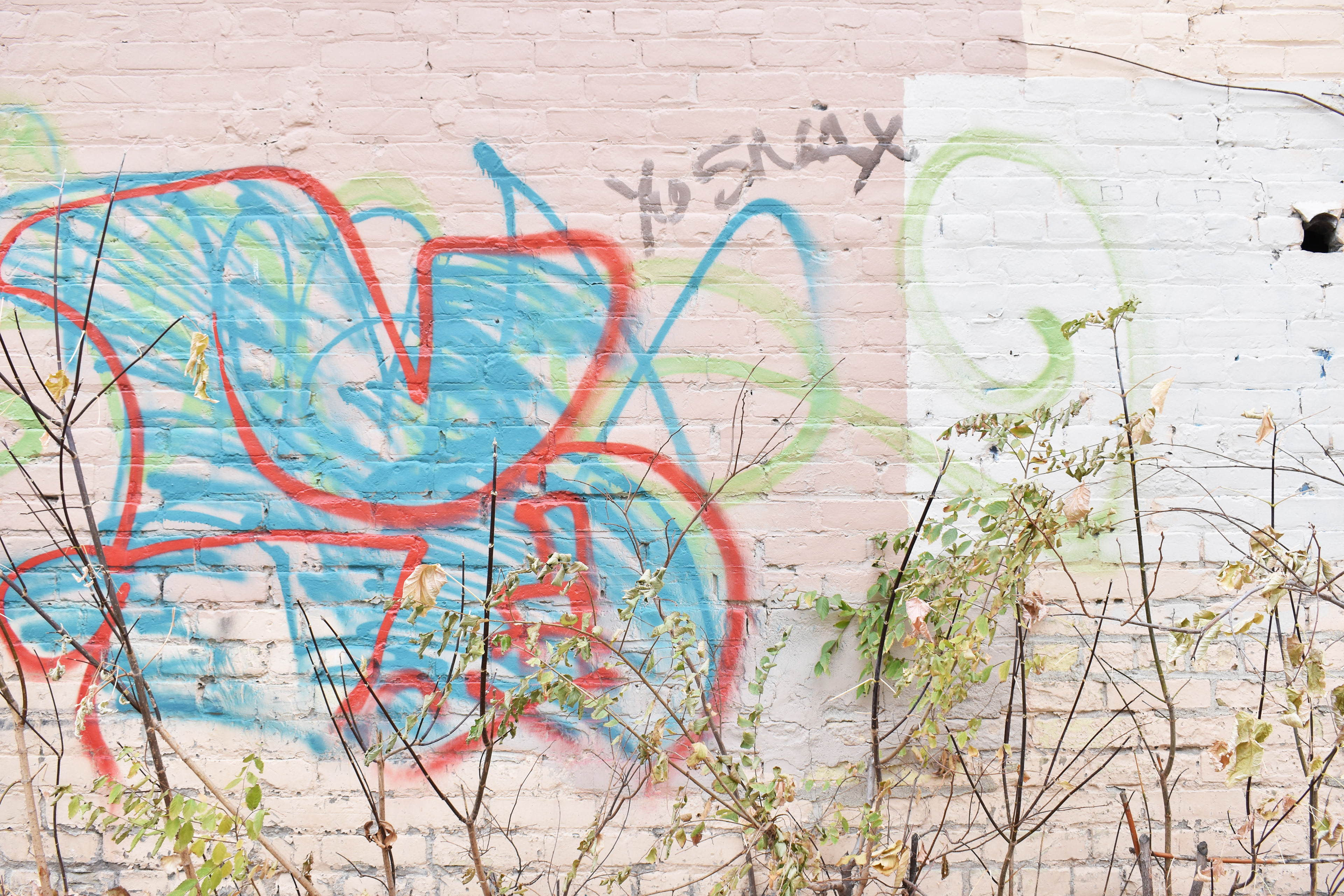

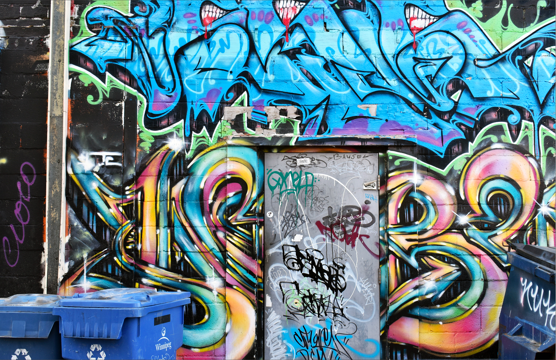

Graffiti is created using spray paint. Several trials were carried out with this same medium to map the site. Although these trials ultimately did not produce clean, clear results, they did provide guidance for the final map.
Sketches of the field of view revealing that only a very small amount of graffiti can be noticed from the sidewalk.
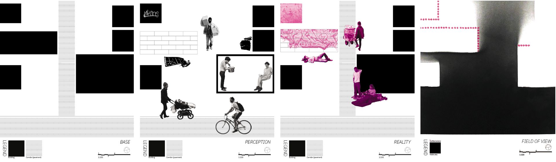
Map iterations - The first three maps explore the theme of perception versus reality, much like the collage. The final map in this series is the outcome of the spray paint trials, which informed the final digital map.
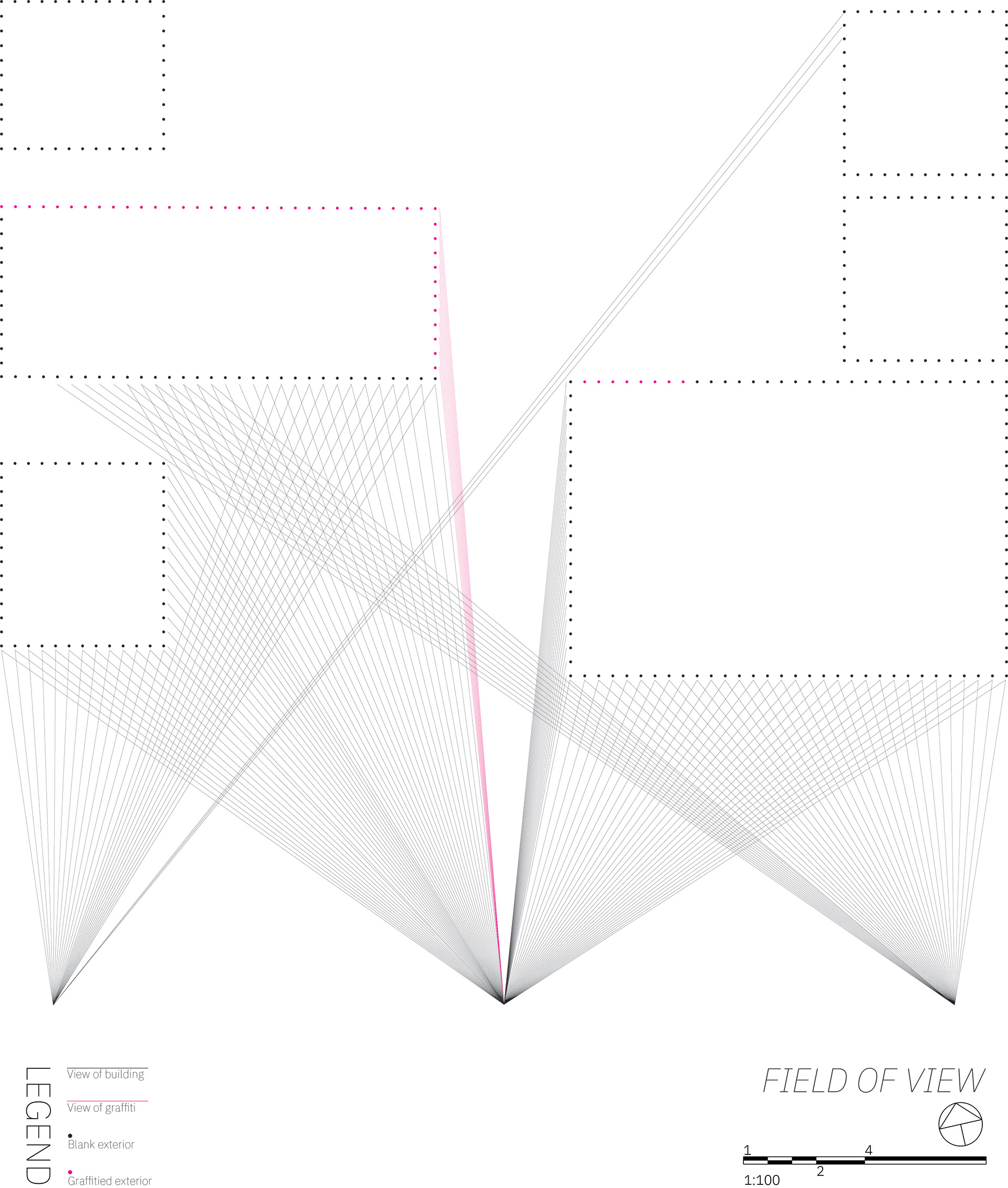
Based on findings from the spray paint map, the field of view from several points are mapped. These locations were identified to be the points at which the most building surfaces are visible. Even at these points of high visibility, nearly all of the alley graffiti is hidden.